
The problem
Methane has caused about 30% of global warming since the start of the industrial era. Because it breaks down in roughly a decade, cutting methane is the fastest lever available to slow warming in the near term. A large share of human methane comes from a small number of “super-emitters”: leaking wells and pipelines, venting compressors, coal mine shafts and poorly managed landfills.
The trouble is finding them. Ground surveys are slow and expensive, and operators often do not know they have a leak. Global methane satellites such as Sentinel-5P see the big picture, but their pixels are kilometres wide, too coarse to point to a specific facility. What regulators and companies need is a satellite that can say “this plume, from this site, at this rate”, quickly enough to act.
The product
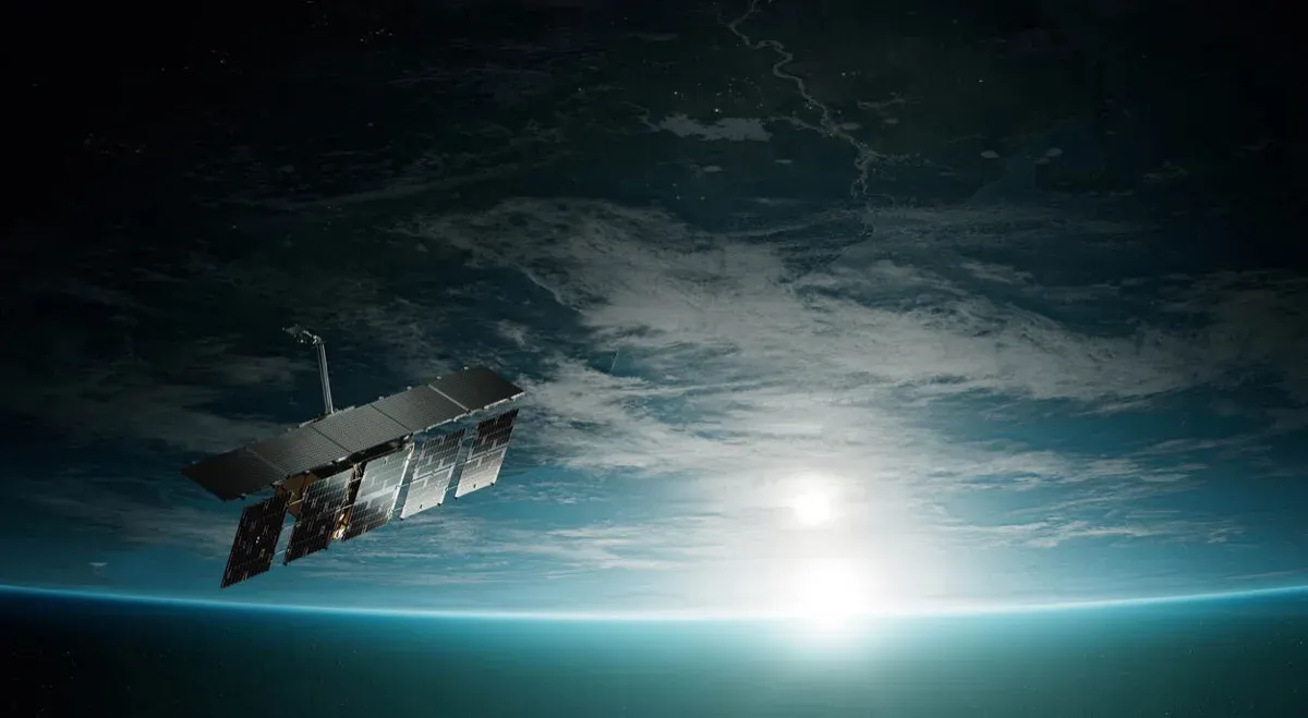
Tanager-1 was built to do exactly that. Planet launched it on 16 August 2024 on SpaceX’s Transporter-11 mission, alongside 36 of its SuperDove imaging satellites (Planet, August 2024). Its heart is an imaging spectrometer designed by NASA JPL, which divides reflected sunlight into 424 narrow bands across the visible and shortwave infrared, from 400 to 2,500 nm, at 30 m spatial resolution (Planet, Tanager).
The Carbon Mapper Coalition brings together the nonprofit Carbon Mapper, Planet, JPL, the California Air Resources Board and university partners, and is funded largely by philanthropy. Carbon Mapper publishes detected plumes in an open data portal.
How it works
Methane and CO2 absorb sunlight at specific shortwave infrared wavelengths, near 1,650 and 2,300 nm for methane. When sunlight passes through a plume on its way to the satellite and back, those wavelengths come back slightly dimmer. With hundreds of narrow bands, Tanager can detect that faint absorption pattern in each 30 m pixel, map the shape of the plume, trace it back to its origin and, with wind data, estimate an emission rate in kilograms per hour.
A peer-reviewed validation study in Atmospheric Measurement Techniques found detection limits of roughly 64 to 126 kg of methane per hour, depending on surface and conditions (Atmos. Meas. Tech., 2025). The satellite can image about 250,000 km² a day, targeting oil and gas basins, coal mines and landfills. Because the spectrometer records the whole spectrum, not just the methane bands, the same images also reveal CO2 plumes from power plants and industrial sites, and Planet offers the full hyperspectral data commercially for uses such as agriculture, forestry and mineral mapping. That commercial side helps pay for a mission whose methane data are published openly.
Timeline
| Date | Milestone |
|---|---|
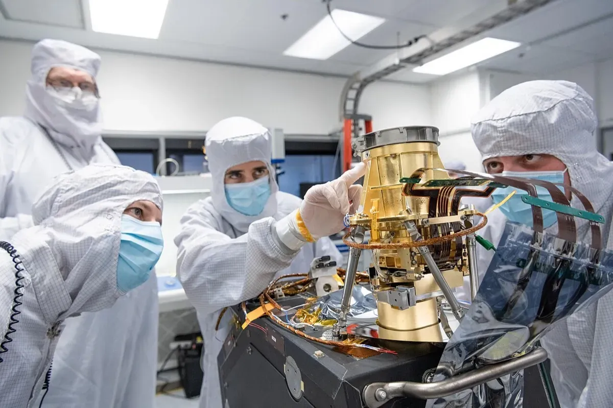
| Apr 2023 | JPL engineers prepare the Tanager-1 imaging spectrometer in the clean room |
| 16 Aug 2024 | Tanager-1 launched on Transporter-11 |
| 19 Sep 2024 | Start of first-year science operations |
| Sep 2025 | First-year results: 5,392 methane plumes published |
| 30 Apr 2026 | Planet and Carbon Mapper agree a new shortwave-infrared Tanager with 100 km swath |
| 1 Oct 2026 | Tanager-2 launched on Transporter-18 |
Impact and numbers
- First year (19 September 2024 to 16 September 2025): 5,392 methane plumes, of which 2,661 came from oil and gas, 1,327 from waste and 1,211 from coal, plus 1,234 CO2 plumes. The data portal had 63,089 users (Carbon Mapper, 2025).
- A leak fixed in days: in the Permian Basin in the US, Tanager detected a leak of about 7,000 kg of methane per hour, and the operator repaired it within two weeks of notification.
- Cumulative results by October 2026: about 15,200 methane plumes from 5,400 sources, more than 460 notifications to operators and 68 confirmed mitigations, which Carbon Mapper estimates prevented 7.8 million tonnes of CO2-equivalent emissions (PR Newswire, October 2026).
- Policy use: data feed the UN Environment Programme’s Methane Alert and Response System (MARS), and California’s methane programme reports 46 mitigated events.
Honest caveats. Tanager sees only in daylight and clear skies, and struggles over water, snow and very dark surfaces. Its detection limit means many smaller, chronic leaks fall below what it can see, so it complements rather than replaces ground measurement. Emission rates depend on wind estimates and carry real uncertainty. The “prevented emissions” figure is Carbon Mapper’s own estimate based on assumed leak durations. Most importantly, detection only helps if someone acts: 68 confirmed fixes from more than 460 notifications shows how much depends on operator and regulator follow-up.
What’s next
Tanager-2 adds capacity from October 2026. In April 2026 Planet and Carbon Mapper agreed a new Tanager focused on the shortwave infrared, with a 100 km swath, which could launch as early as 2028 (Business Wire via StockTitan, 30 April 2026). Europe’s own CO2M carbon dioxide monitoring satellites are scheduled to begin launching in 2027 (WMO OSCAR), adding public, regional-scale measurement alongside point-source detectors such as Tanager.
Why it matters for Europe / green buyers
The EU Methane Regulation (EU) 2024/1787, in force since 4 August 2024, requires oil, gas and coal operators to measure, report and repair leaks, and extends obligations to imports. Importers must show equivalent monitoring standards from 2027, report the methane intensity of supplies from 2028, and meet maximum intensity values from 2030. The regulation creates a global methane monitoring tool and a rapid reaction mechanism that can draw on satellite detections of super-emitters, and allows penalties of up to 20% of annual turnover (EUR-Lex summary).
Since Europe imports most of its gas, independent satellite evidence of upstream leaks in exporting countries will matter to energy buyers, traders and banks. Tanager’s open data let any buyer check a supplier’s basin. For waste operators and municipalities, the satellite’s 1,327 landfill plumes in year one are a reminder that methane is not only an oil and gas issue.
The same logic applies beyond Europe. Fast-growing cities in India, South Asia and Africa rely on large open dumpsites that emit methane and periodically catch fire, and many coal mines and gas fields there have little continuous monitoring. Publicly visible plume data give city authorities, development banks and climate finance programmes a way to target investment in landfill gas capture or leak repair where it cuts the most warming per euro, rupee or dollar spent.
Sources & image credits
- Planet, “Planet Launches First Tanager-1 Hyperspectral Satellite and 36 SuperDoves with SpaceX”, August 2024: https://www.planet.com/pulse/planet-launches-first-tanager-1-hyperspectral-satellite-and-36-superdoves-with-spacex/
- Planet, “Tanager” constellation page: https://www.planet.com/constellations/tanager/
- Carbon Mapper, “Tanager-1: One Year in Space”, 2025: https://carbonmapper.org/articles/tanager-1-one-year-in-space
- Atmospheric Measurement Techniques, Tanager-1 methane detection and validation study, vol. 18, p. 6933, 2025: https://amt.copernicus.org/articles/18/6933/2025/
- PR Newswire, “Tanager-2 Launch to Scale Up Carbon Mapper’s Methane Impact”, October 2026: https://www.prnewswire.com/news-releases/tanager-2-launch-to-scale-up-carbon-mappers-methane-impact-302896690.html
- Business Wire via StockTitan, “Planet and Carbon Mapper Sign Agreement for New Tanager”, 30 April 2026: https://www.stocktitan.net/news/PL/planet-and-carbon-mapper-sign-agreement-for-new-tanager-hdux6y3njqnx.html
- EUR-Lex, summary of Regulation (EU) 2024/1787 on the reduction of methane emissions in the energy sector: https://eur-lex.europa.eu/EN/legal-content/summary/reducing-methane-emissions-in-the-energy-sector.html
- WMO OSCAR, Copernicus Sentinel Expansion Missions listing (CO2M-A, 2027): https://space.oscar.wmo.int/satellites/view/lstm_a
Images:
- “JPL Engineers Work on Carbon Mapper Imaging Spectrometer (PIA25869)” by NASA/JPL-Caltech, public domain, via Wikimedia Commons: https://commons.wikimedia.org/wiki/File:JPL_Engineers_Work_on_Carbon_Mapper_Imaging_Spectrometer_(PIA25869).jpg
.jpg)