The problem
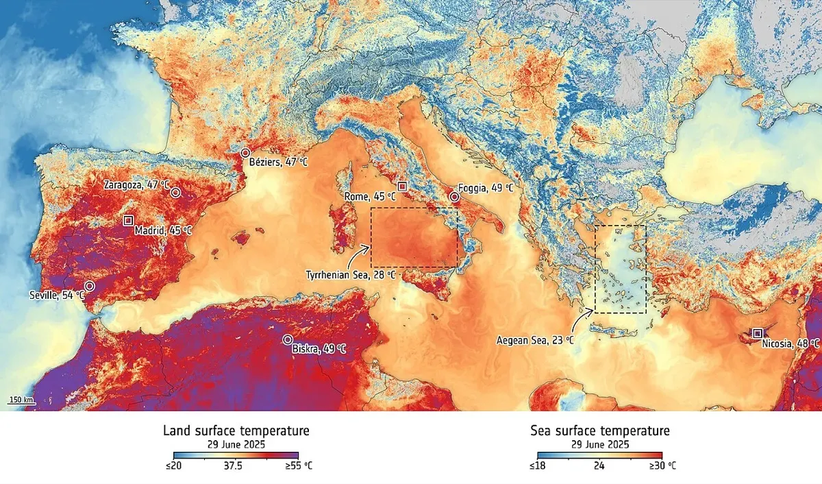
According to the European Forest Fire Information System (EFFIS), wildfires burnt 1,079,538 hectares in the EU in 2025, the largest area since records began in 2006 and nearly double the 2006 to 2024 average. Across all EFFIS countries the total reached 2,242,195 hectares, from 7,783 fires. Portugal and Spain alone accounted for 460,585 hectares, or 43% of the EU total, and 39% of the burnt area lay inside Natura 2000 protected sites (JRC, 31 March 2026).
Speed decides how big a fire gets. Most public fire-detection satellites either orbit the Earth and pass over a given point only a few times a day, or sit in geostationary orbit where pixels are kilometres wide. Fires in Mediterranean Europe often ignite and spread fastest in the late afternoon, when few polar satellites pass overhead. A fire can grow from a spark to an uncontrollable front in the gaps between observations.
The product
OroraTech’s answer is many small satellites carrying thermal infrared cameras, timed to cover the hours that matter. Its first two FOREST payloads flew on satellites built by Spire, which has built 12 satellites for OroraTech since 2021 (Spire, March 2025).
FOREST-3, launched on 14 January 2025 on SpaceX’s Transporter-12, is the first satellite OroraTech designed and built entirely in-house. It is an 8U CubeSat, about the size of a shoebox, with on-board processing that uses artificial intelligence to flag fires in orbit and send alerts faster (OroraTech, January 2025). The mission completed its validation in July 2026 after more than 15 months in orbit, with support from the German Aerospace Center (DLR) and ESA’s InCubed programme.
Ten weeks later came the constellation. Eight OTC-P1 satellites, built on Spire’s LEMUR 8U platform with OroraTech thermal cameras, launched on Rocket Lab’s Electron from Mahia, New Zealand, on 26 March 2025, in a mission named “Finding Hot Wildfires Near You”. They were deployed to a 550 km orbit just four months after the launch contract was signed (Rocket Lab, 26 March 2025).
How it works
Fire is hot, and hot things glow brightly in the mid and long-wave infrared, even through smoke. OroraTech’s cameras measure that infrared radiation and compare each pixel with its surroundings and with recent history. A sharp local jump in temperature is flagged as a probable fire, located on a map and pushed to users through the company’s online wildfire platform.
Small fires matter most. By detecting hot spots as small as 4 x 4 m, the system aims to raise an alert while a fire could still be contained by a single ground crew or aircraft. Timing matters too. The OTC-P1 orbits were chosen to cover the afternoon and the night, filling gaps left by public satellites (OroraTech, March 2025). OroraTech fuses its own data with imagery from more than 25 satellites in its wider network, including public missions, to shorten the time between observations.
Timeline
| Date | Milestone |
|---|---|
| 2018 | OroraTech founded in Munich |
| 2021 onwards | FOREST-1 and FOREST-2 payloads fly on Spire-built satellites |
| 2 Jul 2024 | Greece announces €20 million national wildfire system using OroraTech technology |
| 14 Jan 2025 | FOREST-3 launched on Transporter-12 |
| 26 Mar 2025 | Eight OTC-P1 satellites launched on Electron |
| 3 May 2026 | Hellenic Fire System’s four satellites launched from Vandenberg |
| Jul 2026 | FOREST-3 completes in-orbit validation |
Impact and numbers
- Greece: in July 2024 Greece became the first country to commission a national wildfire satellite system. The €20 million contract is implemented by ESA on behalf of the Hellenic Space Center, with Greek partners including the National Technical University of Athens, the National and Kapodistrian University of Athens, Satways and Attisat (OroraTech, 2 July 2024).
- Launch: the four Hellenic Fire System satellites launched on 3 May 2026, financed through the EU Recovery and Resilience Facility under “Greece 2.0” (OroraTech, May 2026; SpaceNews).
- Users: more than 500 users of the company’s wildfire data, from forest agencies to insurers and utilities.
- Stakes: 39% of the EU area burnt in 2025 was in Natura 2000 sites, so faster detection also protects Europe’s most valuable habitats.
Honest caveats. Detection is only the first link in the chain. A satellite alert saves forests only if fire services have the crews, aircraft and procedures to act on it within minutes, and Greece’s system will be judged on response times on the ground. Thermal sensors can also be fooled by hot industrial sites, sun-heated rock or agricultural burning, so false alarms have to be filtered. A small CubeSat constellation still leaves gaps in coverage, and the detection limit of 4 x 4 m applies under good conditions. Independent figures on how many fires the system has caught earlier than existing tools are not yet public.
What’s next
OroraTech plans to keep adding satellites to shorten revisit times, and FOREST-3’s validated in-house design gives it a platform it controls end to end. The Greek system offers a template other fire-prone countries can copy: a national constellation owned by the state, built and operated with a European supplier, and financed through EU recovery funds. On 25 March 2026 the European Commission adopted a new approach to wildfire prevention and preparedness, which should raise demand for early detection across the Mediterranean.
Why it matters for Europe / green buyers
Europe’s fire seasons are getting longer and spreading north, while firefighting budgets are finite. A thermal satellite network that spots small fires early is one of the cheapest ways to reduce burnt area, emissions and insurance losses. For forest owners, utilities with power lines through woodland, insurers and civil protection agencies, OroraTech offers a European-built service with a working national deployment in Greece. Buyers should ask for documented detection times and false-alarm rates in their own region, and make sure that alerts are wired into an operational response plan.
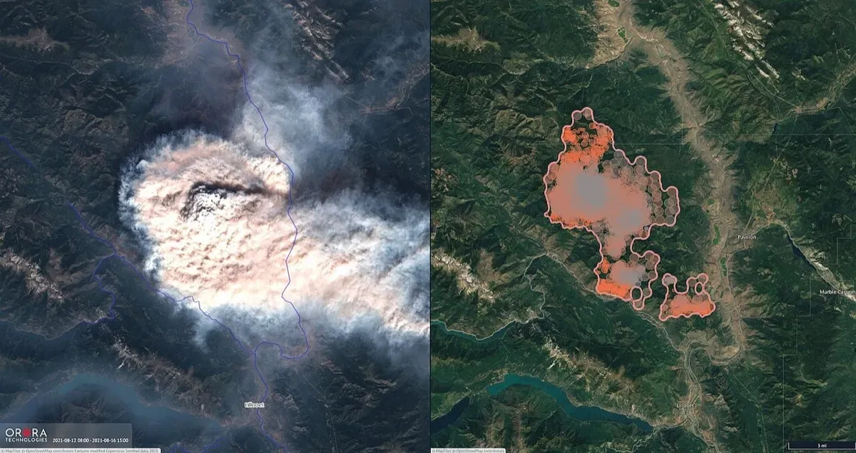
The technology travels well beyond Europe. Canada, Australia, Brazil and India’s Himalayan states all face fires in remote terrain where ground patrols are thin. OroraTech’s British Columbia imagery shows the same system working on another continent, which matters for multinational forestry and insurance buyers who need one consistent data source across regions.
Sources & image credits
- OroraTech, “Launching FOREST-3”, January 2025: https://ororatech.com/resources/news-blog/launching-forest-3
- OroraTech, “OroraTech Launches World’s First Satellite Constellation for Wildfire Detection and Data Accumulation”, March 2025: https://ororatech.com/resources/news-blog/ororatech-launches-world-s-first-satellite-constellation-for-wildfire-detection-and-data-accumulation
- Rocket Lab, “Rocket Lab Successfully Launches Mission for Global Wildfire Detection Company OroraTech”, 26 March 2025: https://rocketlabcorp.com/updates/rocket-lab-successfully-launches-mission-for-global-wildfire-detection-company-ororatech/
- Spire Global, “8 Spire-built satellites launch with OroraTech infrared cameras for wildfire detection from space”, March 2025: https://spire.com/liftoff/8-spire-built-satellites-launch-with-ororatech-infrared-cameras-for-wildfire-detection-from-space/
- OroraTech, “Greece First Country to Build a National Wildfire System Using OroraTech Technology”, 2 July 2024: https://ororatech.com/resources/news-blog/greece-first-country-to-build-a-national-wildfire-system-using-ororatech-technology
- OroraTech, “Greece Launches World’s First National Wildfire Satellite System”, May 2026: https://ororatech.com/resources/news-blog/greece-launches-world-s-first-national-wildfire-satellite-system
- SpaceNews, “OroraTech deploys wildfire constellation for Greece”, May 2026: https://spacenews.com/ororatech-deploys-wildfire-constellation-for-greece/
- European Commission Joint Research Centre, “2025 was EU’s most destructive wildfire season on record”, 31 March 2026: https://joint-research-centre.ec.europa.eu/jrc-news-and-updates/2025-was-eus-most-destructive-wildfire-season-record-2026-03-31_en
Images:
- “OroraTech wildfire detection in British Columbia” by OroraTech (incorporating MapTiler, OpenStreetMap and modified Copernicus Sentinel data), published by ESA, licensed CC BY-SA 3.0 IGO (https://creativecommons.org/licenses/by-sa/3.0/igo/), via Wikimedia Commons: https://commons.wikimedia.org/wiki/File:OroraTech_wildfire_detection_in_British_Columbia_ESA25191053.jpg